


C-MAP Boating
4.1674.00 Reviews
App Specs
- Version
- 4.6.0
- Updated On
- License
- Free
- Downloads
- 1,000,000+
- Developer
- Navico Norway AS
- Categories
- Maps & Navigation
- Platform
- Android
Screenshots
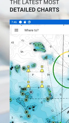
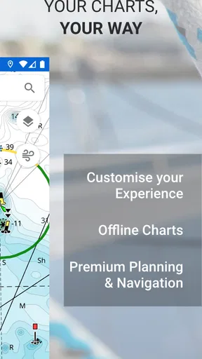
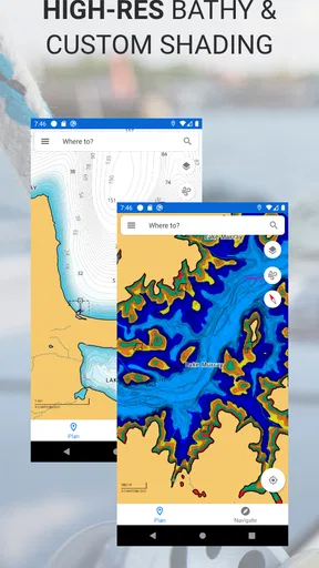
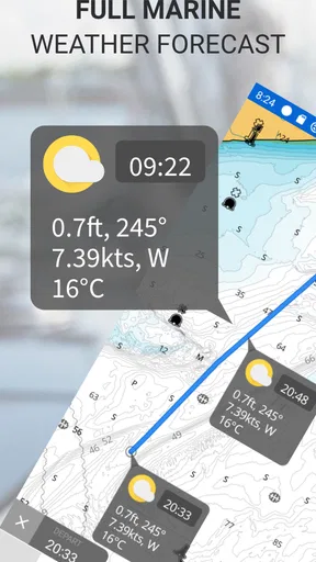
 Analysis by AppCompare
I don’t judge a boating navigation app by how quickly it opens on land; the more important question is whether it stays useful when a trip gets busy, the shoreline changes, or mobile coverage fades. C-MAP Boating is built for that marine context, and I find its strongest appeal in having chart information and route planning together on a phone. It is a free Maps & Navigation app from Navico Norway AS, with optional in-app purchases ranging from $0.99 to $99.99 per item. The range is worth keeping in mind: I’d check what a particular purchase unlocks before relying on it for a planned trip.
What “fast” means on the water
For me, speed here is less about flashy animation and more about reducing the time between asking “what’s ahead?” and seeing useful chart context. A chartplotter-style map is a better fit for boating than a conventional road map, which is designed around streets and driving directions. The app’s marine focus makes it a natural place to inspect a water route, but I would still treat route suggestions as planning assistance rather than an instruction to follow without judgment.
That distinction matters most in unfamiliar water. Before leaving, I’d look over the route at a comfortable pace, check the chart around turns and narrow passages, and note where I may want to reassess once underway. This small bit of preparation is more valuable than expecting any phone app to make every decision for me. It also gives me a practical way to judge whether the app’s pace feels responsive enough for my style of trip: can I understand the chart before I need to act?
When the trip gets demanding
A quiet evening of route planning is not the same as using a map while handling a boat, watching conditions, and talking with passengers. I would avoid treating a phone screen as something to stare at continuously. I’d plan first, keep the display interaction simple once moving, and use the chart to check position and surroundings at sensible moments. That is a safer and less distracting workflow than trying to make decisions by tapping around under pressure.
Offline maps are especially relevant when a route takes you beyond dependable mobile coverage. I’d download the chart area before setting out, while connected, and confirm that the region I need is available for offline use rather than assuming a broad area is already stored. That preparation can also help avoid a frustrating last-minute download at the dock. Offline availability is useful, but it should not be confused with a guarantee that every online function will behave identically without a connection.
Reliability is a preparation habit
I’m cautious about calling any phone-based navigation setup a complete substitute for seamanship or dedicated equipment. C-MAP Boating can make chart information more convenient, but the sensible approach is to check the route before departure and keep awareness of the boat and conditions ahead of the screen. If navigation is safety-critical on a longer outing, I would not make a single phone app my only plan.
For a realistic short-trip routine, I’d choose a destination, review the route and nearby water, download the needed maps, and make sure the phone is ready before leaving shore. Once underway, I’d use the display for occasional position and chart checks instead of constantly changing settings. This is a small workflow, but it helps separate planning from piloting and makes the app easier to use when attention is divided.
Worth Reading Before You Choose

EA SPORTS FC Mobile 26 Is a Bigger Football Game, but It Takes Time

Flipboard Shows What News Apps Must Do Beyond the Feed

Switching to Android Auto Means Rethinking Your Driving Routine

Google Calendar Makes a Crowded Week Easier to Manage

Ludo King Makes the Most of the Minutes Between Plans

Baby Panda World Brings Quick Play to Modern Phones, but Its Game Library Feels Busy
First Impressions
Jumping into the app, the first thing that struck me was its sleek design. It's like the developers knew exactly how to make it easy on the eyes while packing in all the necessary features. The user interface is intuitive, with everything just a tap away. No more fumbling around like a fish out of water!
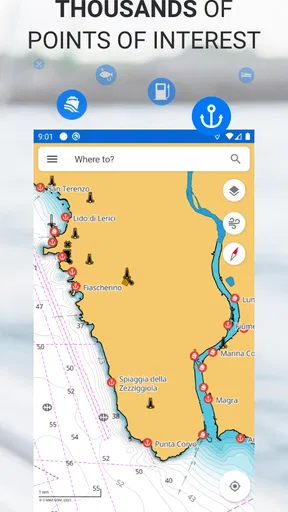
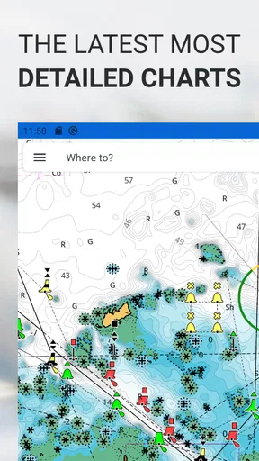
Once inside, you'll find a vibrant map that covers a vast array of water bodies. Whether you’re navigating the lakes or hitting the high seas, C-MAP Boating has you covered. The maps are detailed, offering everything from depth contours to port plans. It’s like having a nautical chart in your pocket but way more interactive.
Features That Float My Boat
Now, let's talk about the features, because this app is packed with them. One standout is the offline map capability. You can download maps for offline use, which is a game-changer when you're out of range and need to rely on your digital co-pilot. Plus, the GPS tracking is spot-on, ensuring you never lose your way.
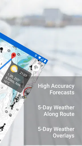
The weather forecasting feature is another gem. It provides real-time weather updates, so you can plan your trips around Mother Nature's moods. Trust me, knowing whether you'll be cruising under sunny skies or dodging a storm is invaluable.
On top of that, there’s the community aspect. You can share routes and tips with fellow boaters, making it a social experience. It’s like having a boating club at your fingertips!
Setting Sail with Ease
Getting started with C-MAP Boating is smoother than a dolphin’s back. The app walks you through the setup, from downloading maps to setting your preferences. It even offers tutorials for those who might need a bit of guidance. And if you’re anything like me, you'll appreciate the little nudges in the right direction.
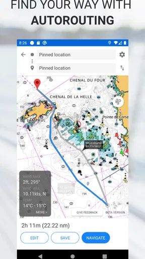
One of my favorite things is the auto-routing feature. It calculates the best route for you, considering all the important factors like tides and hazards. It’s like having a personal navigator who never sleeps. This is especially handy when exploring new waters.
Who will get the most from it
I think this app makes the most sense for recreational boaters who want a chart-focused companion for familiar outings as well as occasional exploration. A lake user can plan a route and check depth contours; someone visiting a new harbor can use the chart context to get oriented before approaching. The benefit is not simply having a map on a phone, but having a marine view that helps make planning feel less like guessing.
It may be less suitable if you mainly need turn-by-turn road navigation, want a general travel map, or are looking for a dedicated helm display to replace established onboard equipment. In those cases, a road-map app or a purpose-built marine plotter is a better match. I’d also skip relying on it as my sole navigation resource for a demanding passage. Convenience is valuable, but it does not remove the need to understand the route and conditions yourself.
A practical day-trip workflow
Imagine heading out for a weekend afternoon on a lake you know reasonably well, with a stop at a shoreline destination you have not visited before. I’d use the calm time before departure to inspect the planned path, check the chart near the destination, and save the relevant map area for offline use. If the weather view is part of my planning, I’d consult it before setting off rather than treating a phone screen as a substitute for watching conditions.
Once the boat is moving, I’d keep the phone accessible but avoid making frequent adjustments. If a route looks questionable or conditions change, I’d pause to reassess rather than blindly trusting an automatically suggested line. This is one of the more useful trade-offs with route automation: it can save planning effort, particularly in unfamiliar water, but a suggested route still needs a human check against local circumstances and the boat’s capabilities.
Offline planning and route sharing
One practical detail I would not leave until the last minute is map preparation. Downloading the area while connected gives the offline feature a clear purpose, especially if the outing may pass through places with weak reception. I’d also open the saved region before departure to make sure I have the coverage I expect. That quick check is easy to forget, yet it can prevent discovering a gap only after leaving the dock.
Route sharing can be useful when a group is coordinating a trip or when someone wants to pass along a suggested course. I’d treat a shared route as a starting point, not as proof that it suits every boat or today’s conditions. A route made for another person’s outing may reflect different preferences and circumstances, so checking it against the chart before using it is a sensible habit.
How it compares with other navigation choices
Compared with a standard map app, C-MAP Boating is aimed at people who need marine chart context rather than street names and driving instructions. That focus is its clearest advantage. Compared with dedicated chartplotter hardware, a phone app is more convenient to carry and can be handy for planning away from the helm, while a dedicated unit may be preferable for someone who wants navigation built into an onboard setup. I see the app as a practical companion, not an automatic replacement for every tool a boater already trusts.
There is also a difference between an app that helps plan and one that can be depended on as the only source of guidance. I’d use C-MAP Boating to prepare, inspect chart details, and check position, while keeping broader awareness and a backup plan in view. That balanced role suits casual trips particularly well; people who need a fully equipped, always-on navigation station should compare it with dedicated marine hardware before deciding.
Device demands and purchase choices
Because this is a phone-based charting tool, the device itself is part of the setup. A readable screen and enough battery for the outing matter in practice, especially if the phone is also being used for communication or other tasks. I’d begin with the app’s free option, explore the areas and tools relevant to my boating, and only consider a purchase once I understand what I need. The available in-app purchases span a wide range, so checking the item details before paying is more useful than assuming every boater needs the same upgrade.
The app is rated for Everyone and has been available since January 28, 2016. Its current version is 4.6.0, and it requires Android 10 or later, so an older Android phone may not be able to run it. I would check compatibility before planning around the app, and I’d avoid waiting until the day of a trip to install or prepare it. On iOS, I’d check the device’s current store page for compatibility before downloading.
How I judge reliability and recovery
In marine navigation, reliability is not just whether an app opens; it is whether I have prepared enough to recover sensibly if something interrupts the plan. Offline map preparation reduces dependence on a live connection for chart access, while reviewing the route before departure means I am not trying to learn the interface at a stressful moment. I’d keep the phone charged and avoid assuming that a single digital display is an adequate backup for every outing.
If the map does not appear to cover the route I want, I’d stop and check the selected area and saved map before leaving, rather than assuming the app will fill in missing information later. If conditions no longer suit the original plan, I’d reassess instead of following an auto-route simply because it is available. Those are basic habits, but they matter more than expecting any navigation app to recover automatically from every bad decision or device problem.
What the ratings suggest, and what they cannot decide
C-MAP Boating has an average rating of 3.4 from around fifteen thousand ratings, with roughly six hundred and fifty written reviews, and it has passed one million installs. I take that as evidence that it has reached a substantial boating audience, not as a guarantee that it will fit every phone, region, or style of trip. The practical test for me is whether its charts, offline preparation, and planning tools match the water I actually use.
I would try it first on a low-pressure outing, when I can explore the map and route workflow without needing to make a rushed decision. That gives me a chance to judge whether the screen is comfortable to read, the chart view makes sense to me, and the offline preparation fits my routine. If it feels cumbersome in those conditions, I would not expect a busier trip to make the experience easier.
Anchors Aweigh: Final Thoughts
After spending some quality time with C-MAP Boating, I can confidently say it’s a must-have for any boating enthusiast. It's user-friendly, feature-rich, and reliable. Whether you're planning a short trip or a long voyage, this app has your back.
Sure, like any app, it has room for improvements, like even more customization options or integrating with smart devices. But as it stands, it's already making waves in the boating community for all the right reasons.
So, if you're ready to enhance your boating experience, give C-MAP Boating a try. It's a breath of fresh sea air in the world of marine navigation apps.
Pros
- Intuitive interface for easy navigation.
- Extensive chart coverage worldwide.
- Real-time weather updates available.
- Seamless offline mode functionality.
- Customizable route planning tools.
Cons
- Premium features require a subscription.
- Initial setup can be time-consuming.
- Occasional GPS signal dropouts.
- Limited social sharing options.
- App size might impact device storage.
FAQs for C-MAP Boating
What is C-MAP Boating and what features does it offer?
C-MAP Boating is a navigation app designed for marine enthusiasts, offering detailed nautical maps and charts. The app provides real-time weather updates, tide information, and route planning. It also includes features such as AIS data for tracking nearby vessels, community data for shared insights, and offline map capabilities for use without an internet connection.
Is C-MAP Boating available for both Android and iOS devices?
Yes, C-MAP Boating is available for download on both Android and iOS platforms. Users can find the app on the Google Play Store for Android devices and the Apple App Store for iOS devices. The app is designed to function seamlessly across different devices, offering a consistent experience for all users.
Does C-MAP Boating require a subscription for full access?
C-MAP Boating offers a free version with basic features, but to access premium features such as advanced weather data, offline maps, and custom route planning, a subscription is required. The subscription plans are available at various price points, allowing users to choose a plan that best suits their needs and usage preferences.
Can I use C-MAP Boating offline, and how do I access offline maps?
Yes, C-MAP Boating offers offline capabilities. Users can download maps for specific areas to ensure navigation is possible without an internet connection. This is especially useful in remote areas where connectivity is unreliable. To access offline maps, users need to subscribe to a premium plan, which allows them to download and store maps on their device.
How accurate and reliable is the navigation data in C-MAP Boating?
C-MAP Boating uses highly accurate and reliable nautical data, sourced from official hydrographic offices and updated regularly. The app provides detailed charts and real-time updates, ensuring users have access to the most current information available. Additionally, user-generated community data helps enhance the reliability of navigational insights provided by the app.


